FLOODLABEL
Floods are major hazards
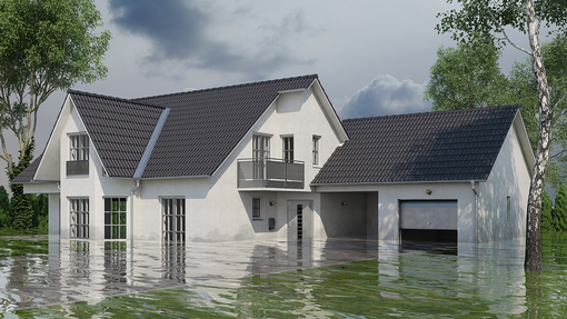
Extreme flooding threatens life in urban areas
To protect cities from flooding and other types of inundations, traditional government-led flood protection needs to be complemented by homeowners’ adaptation. Now, especially homeowners lack risk awareness, and knowledge of measures and triggers to take action. This project aims to design, test and implement a smart governance tool—the FLOODLABEL—in urban living labs. This prototype tool serves to inform homeowners about their individual flood risks and to support the planning and decision-making of experts and local governments to achieve more flood-resilient cities.

RISK POTENTIAL AT A GLANCE
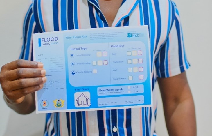
The homeowner receives an expert risk assessment for their property and recommendations on how to take precautions to reduce the risk of flooding/heavy rain. The FLOODLABEL also provides evidence of the extent to which the building is at risk from, protected against or adapted to flooding, heavy rainfall, sewer backflow and groundwater flooding.
The FLOODLABEL is useful when selling, renting or insuring a building because it assesses the risk of flooding.
Click here for the FLOODLABEL Homepage.

Insurance Companies Support the FLOODLABEL
The FLOODLABEL is supported by several insurance companies in case of damage:
The greensFAIR® ESG Supplementary Conditions developed by the Greensurance Foundation include measures for climate adaptation (risk provision for natural hazards), which are borne by the insurer.
Here the FLOODLABEL is provided as part of the "Prevention against the dangers of climate change" and is part of the EXCLUSIVE Green Fair Play Plus home insurance cover.
The FLOODLABEL has been adapted and proven in Germany. Through projects and partners, our experience is growing and adapted to different countries.
If you are interested in the FLOODLABEL, feel free to contact us.
CHECK OUT OUR INTERNATIONAL PROJECTS:
JPI Urban Europe
A smart tool for governance towards flood-resilient cities.
JPI-Project
The JPI research project aims to improve resilience and adaptive capacity of cities in a smart manner to sustain urban living in Europe. While adaptation measures to reduce the impact of flooding exist, homeowners insufficiently implement them due to their lack of risk awareness and knowledge of measures and triggers to take action. The project explores dedicated geo-technology and ICT-supported risk communication approaches and tools to better understand how risk communication.
HKC therefore collaborated with academic and societal partners in Austria, the Netherlands and Flanders in this project funded by the JPI programme Urban Europe. Next to a prototype of a risk communication tool has been developed (see below), multiple academic publications, living labs, and societal outreach have been produced.
FLOODLABEL.net is a prototype application developed under the JPI Urban Europe funding program. It illustrates how homeowners can be informed about their individual flood risks and to support the planning and decision-making of experts and local governments to achieve more flood-resilient cities. The prototype was developed within the research project for selected Dutch case study areas. It is only available in Dutch.
Floodlabel for Ghana
Improve flood prevention and coping systems in Ghana
PARADeS-Project
Ghana is one of the countries in West Africa most affected by flooding. In addition to the annual flooding events, Ghana is subject to many flood-induced cascade effects, resulting in the collapse of critical infrastructure.The effectiveness of risk management is deficient due to the existing risk management infrastructure and governance structures.
The HKC is part of the cooperative project "Participatory assessment of flood disaster prevention and development of an adapted coping system in Ghana - PARADeS“. The project is lead by the Department of Geography, University of Bonn.
The PARADeS project aims to contribute towards enhancing Ghana’s flood disaster risk reduction and management strategy by investigating existing flood risk and disaster management to reduce the risk and increase the security of the society. Within the project scope of the HKC, the floodlabel concept is transferred and adapted to these conditions.
PARADeS is financially supported by the Federal Ministry of Education and Research (BMBF), under the program Research for Civil Security“.

Project partners
Germany
- Department of Geography, Research group Eco-Hydrology and Water Resource Management, University of Bonn
- Research group Environmental Policy, University of Freiburg
- Research group Flood Risk Management, University of applied sciences Magdeburg-Stendal
- HochwasserKompetenzCentrum e.V. (HKC)
Ghana
- West African Science Service Center on Climate Change and Adapted Land Use (WASCAL)
- Water Resources Commission (WRC)
- National Disaster Management Organisation (NADMO)
In cooperation with
- MIASA Centre for Advanced Studies (CAS), University of Ghana
- Federal Office of Civil Protection and Disaster Assistance (BBK)
Case studies areas
Accra - pluvial and coastal floods
Kumasi - pluvial and fluvial floods
Volta river basin - fluvial floods

Further program information can be found on the Project-Page and under the following links:
https://www.geographie.uni-bonn.de/parades/de
https://www.sifo.de/..parades_node.html
Floodlabel for Iran
Floods in dry regions of the world
HOWAMAN-Project
Managing flood risks in dry regions of the world is particular challenging.
In contrast to droughts, hazards from flooding are often neglected due to the low annual rainfall.
The lack in knowledge, awareness and preparedness to floods on private and public level in combination with potentially poor building design, poor spatial planning and rare events of heavy rains lead to an underestimated flood risk.
In order increase flood resilience, the floodlabel concept aims to lower flood risks by actively integrating the population under risk.
The HKC is part of the cooperative project “Sustainable strategies and technologies for flood risk management in arid and semi-arid regions” (HOWAMAN).
The project is lead by the Institute of Hydraulic Engineering and Water Resources Management of the RWTH Aachen University.


All project partners are shown in the list below:
- Institure of Hydraulic Engineering and Water Resources Management, RWTH Aachen
- Institute for Water and Waste Management at RWTH Aachen e. V.
- Institute for Sociology, RWTH Aachen
- Research group Flood Risk Management, University of applied sciences Magdeburg-Stendal
- Kisters AG, Business Unit Water
- DMT GmbH & Co. KG, Segment for Hydrogeology and Water Management
- HochwasserKompetenzCentrum e.V.
HOWAMAN is financially supported by the Federal Ministry of Education and Research (BMBF), under the programm "Research for Civil Security".
Within the project scope of the HKC, the floodlabel concept is transferred and adapted to these conditions.

Further program information can be found under the following links:
https://www.sifo.de/../howaman.html

